Arizona Route 66

Arizona to New Mexico Route 66

One of the first things I thought about moving to Phoenix was relief.    Relief that I didn’t have to be trapped by weather to not go riding whenever I wanted to in December, or whenever.    Sure, it gets hotter than hell down here, but you don’t slide sideways into a ditch because of the heat, and you sure as fuck don’t have to shovel it off your doorstep in the mornings and scrape it off the windows.    If you live in the desert long enough, you become a desert rat, at least I did.     I’m lucky enough that my wife is on board and she loves the desert as much as I do.    To me, the Desert means freedom.

I didn’t exactly know what the Monsoons were though before I moved down here.    You still have the check the weather to go for long rides, because the thunderstorms down here are biblical.  The dust storms that sometimes precede them are pretty epic as well.     This ride had been planned 2 weeks earlier, and although I don’t really mind riding in the rain, its better if the weather is good.    It looked like it was going to be nice this last weekend, and Friday morning I loaded up the bike and planned to leave early and get to Albuquerque and explore some new roads I’ve never seen.    Once there, I’d figure it out where to go next on Saturday morning.

Getting Ready to Ride from Tempe to New Mexico
My Boss is always telling me I need to come to work prepared…   

I left work around 1 and hit the road, up Arizona 97 toward Payson and into some higher country.   It was around 110 degrees and pretty hot, but the road climbed quickly and I knew it wouldn’t last long.

Star Valley Arizona – Resting my ass and taking in the scenery

I got out before the weekend traffic and the roads were killer, and the weather cooled down 25 degrees.    It was awesome.   This has always been my theory:  It takes 3 days to have a good ride, at least:  the first day all the bullshit drains out, the second day you feel like yourself again, and the third day is just pure inspiration.    I think the more of a 2 lane road you get the faster the bullshit drains out, and as I got further and further away from home the ride just kept getting better.    I was starting to realize I had a whole weekend of this.   It was starting to get really damn enjoyable.

I went through Springerville AZ, gassed up, stuffed some beef jerky into my vest pocket and headed on down the road — the sun was going down and I wanted to see as much of the country as I could.   I knew I’d be pulling into Albuquerque in the dark.    I hit the road.  The sunset was at my back and the shadows were getting tall and the weather a little cooler.   Perfect riding.

New Mexico Harley Davidson Border Crossing
Welcome to New Mexico. I hit the border by dusk and saw the landscape start to open up, New Mexico Style.   

About a half an hour later, it was dark.     I started heading north on New Mexico 36, and decided I wasn’t going to make ABQ tonight.    I knew there was a KOA in Grants that was closer, so I decided to ride there, crash for the night and figure it out in the morning.    I twisted the throttle and enjoyed the ride, happy in my new plan.

You gotta love riding at night in the Desert, especially on a new road.  Up north, I always worried about critters on the road like Deer, elk and even moose at night.   I suck at spotting Deer during the day, let alone at night.   A perk of the desert is the night riding.    You can relax a little, sing out loud without looking like a moron,  and enjoy the ride.

Harley Night Riding
Somewhere outside Techado New Mexico.

I passed some pretty cool scenery I think the last 40 miles into Grants.   It was pitch dark with no moon but my headlight was picking up the sides of some massive rock formations.  The turns in the road said this was interesting terrain,  I just couldn’t see any of it.    Another nice surprise that I’ll need to go back and check out.  El Malpais National Monument is what I was missing it turns out.   Even as I type this out I’m curious as to what I missed —  I’ll go back again.

I rolled into Grants about 10pm.   The Lady at the KOA was a sweetheart and gave me an upgrade from a tent spot to a cabin for 10 bucks.   I guess the thought of setting up a tent and sleeping on the ground made me an easy sell.    I called Missus Zip, watched the local news, checked the weather and was asleep in an hour.

Day 2:

I was up at 5.    Some call it a curse to be an early riser, but by God I think its a blessing.    Especially on a route 66 road trip by yourself.   I was stoked, and the day was mine.

My $10 cabin upgrade on a route 66 morning.
A New Mexico Sunrise

I showered, watched a couple of Episodes of the Rifleman while I drank coffee and it warmed up a little.   I decided to head Toward Albuquerque on route 66 and double back toward Flagstaff

Wait though, the Rifleman — I’ve never watched it before.     Two thumbs up!!

Budville New Mexico Route 66

Budville New Mexico Route 66 – Bitchen old sign.


Budville Trading company
Budville was named after “Bud” Rice who was a character of sorts. Some loved him, some hated him. He was a local entrepreneur, philanthropist, Justice of the peace and some say local con-man. He ran this place from 1929 to 1967 when someone robbed the place and shot him in front of his wife Flossie. The crime was never solved. Budville Trading company was open for 66 years and finally closed in 1994.    Lots of Stories on Route 66….
Budville Route 66
Looks like Bud even had him some shacks you could rent for the night, motor court style.

San Fidel New Mexico Route 66

An Old Whiting Brothers Gas Station Sign — San Fidel New Mexico


Whiting Brothers San Fidel New Mexico Route 66
There used to be hundreds of Whiting Brothers filling stations across the US — at least 40 on route 66 alone.  Started in 1926 with the birth of route 66, they included gas, groceries, motels with a slogan of “quality gas for less.”  The business slowed in the 70s with the fuel shortages and the building of the Interstate.   By the 80s, they were all but gone.


Lots of Ghosts here. If you keep your eyes peeled, you’ll still see Whiting Brothers signs all up and down route 66 today.   There’s a restored one in Moriarty New Mexico, East of ABQ.  

I was glad I doubled back.   It rained a little here and there, but I was enjoying the 160 mile ride from Grants to Albuquerque to Grants again.    I wished I’d had taken more pictures.

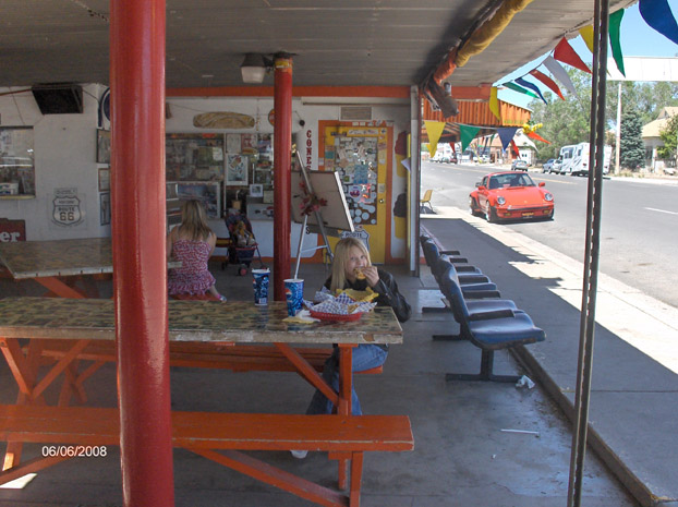
Grants has lots of great history — It started out as a railroad town in the 1880s, became a logging town till the 1930s, and was mostly known as a Uranium mining town till the 1980s.   When the mining boom ended, Grants went through a pretty rough time.   Tourism and the resurgence of Route 66 has brought it back.    Its still one of my favorite route 66 towns.

Grants Cafe Route 66
Grants New Mexico Cafe

I stayed on route 66 west bound, avoiding as much interstate as I could.   The clouds and rain started to clear, and the sky started opening up.   It was turning out to be a helluva good day to ride.

The Continental Divide – New Mexico 

I rode through Gallup and on through the border back into Arizona.

Side note:   One of the things about riding is you don’t miss much of the experience.    You’re part of it, rather than just observing it.   The heat, the cold, the weather, the smells.    It heightens your senses I think.      I noticed the predominant smell in New Mexico is weed.  Most of the place smells like Marijuana, and I don’t know why.    I think everyone smokes pot there.  Just an observation…

Arizona Route 66!

Chief Yellowhorse — A route 66 Classic. Right on the Arizona/New Mexico Border

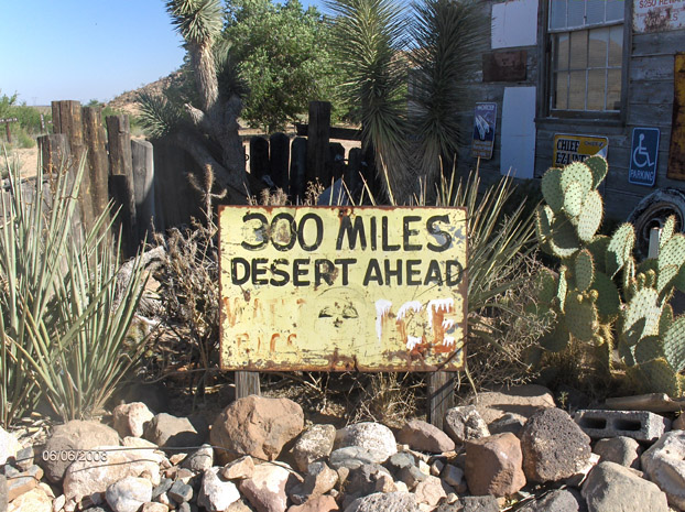
If you don’t rubberneck and look for side roads, or have a good Route 66 map made by those in the know, you’ll miss a lot of great spots on the Mother road.  The interstate signs don’t always tell you where some of the best parts of route 66 are.   This is one of my favorites — the Querino Canyon Bridge.

Querino Canyon Bridge on old Route 66
Querino Canyon Bridge, Houck Arizona — This was route 66 from 1929 to the 1960s when they built the Interstate.   It still serves the local traffic. 
Querino Canyon Route 66 Bridge
Querino Canyon Bridge.   She’s a beautiful old Gal….

It started getting hotter as I rolled on through Joseph city, Jackrabbit City, did a couple of laps through Winslow.   I opened it up and headed toward Flagstaff.

Flagstaff Arizona? Don’t Forget Winona — Walnut Canyon Bridge, Winona Arizona.

I rolled into flagstaff KOA that evening after riding for 12 hours,  feeling pretty tired and just wanting to set up my tent and crash for the night.     I rolled into my tent spot and my overly-enthusiastic camping neighbor was on me before I could even shut the bike off.    I could appreciate that kind of friendliness normally, but I guess he couldn’t see by the look on my face that I was beat, and it wasn’t all that mutual  right now.    He kept touching my bike, peppering me with questions about where I’d been, what year my bike was, how long I’d been riding….. it to the point I thought there was something wrong with this guy.

He asked what I did;   I looked at him and said — “I just got out of Prison and I’m re-building my life”.

It worked.

I set up my tent, called missus Zip to let her know I was ok, and crashed for the night.

Day 3:   Flagstaff to Home

I woke up, showered and broke down my tent.    It’d been a damn fine ride, and I could be home in 2 hours if I hauled ass, but I wasn’t ready to end my ride.

Getting ready to break camp and head home from Flagstaff


Heading down the 17 into the Valley

I got off the interstate as quick as I could, and hit the back roads toward Payson AZ again to head home.  Another new road.

The road from Camp Verde is an awesome ride, one I’ll want to take again. Back on AZ 87, heading toward Payson
Bike Selfie.

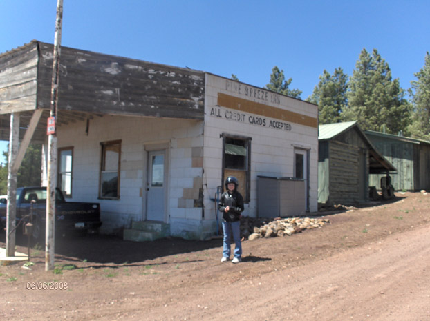
Arizona is my favorite state.    It has it all:   The desert valleys, lots of old history, mountainous Ponderosa pine forests, sane gun laws, the Grand Canyon, route 66 and high desert plains.  I rolled down slowly off the mountain and found a couple of cool little towns I want to go back and explore again.   Strawberry AZ and Pine AZ.  Lots of bikers and twisty forest roads.

The traffic was heavy coming off the mountain.    I was tired of following cars so I took a side road toward a historical marker in Strawberry Arizona.

The oldest standing schoolhouse in Arizona. 1884.  

I stopped and ate in Payson, and headed on down the road (and into the heat again) toward Home.

Bush Highway Motorcycle Riding

Saguaro Lake

I was home by 1.    Great ride.   God, I love Arizona.

3 Days, 2 States, 1,110 Miles

Arizona to New Mexico Route 66 Read More »

Flashback: 1991 Arizona Route 66

Labor Day in 1991 was an opportunity for my new bride and I to take a little road trip on the mother road once again, so friday night after we both got off work we headed down to Needles.     I remember listening to Cassette tapes of Roxette most of the way down in our 1986 Mercury Lynx and having a helluva time.

Back then I considered “sleeping in” was waking up at 6 AM, and was able to talk my wife into heading out early and fitting in a trip to Lake Havasu which was not far away.     We woke up, went to the El Garces Harvey House in Kingman, took a few pictures and headed down the Freeway to Lake Havasu.

66 Motel at Dawn
66 Motel at Dawn

After a short visit to Lake Havasu, we headed back north and up to Topock.      The road between Golden Shores and Oatman was gravel back then, but it was just good to be on the mother road again and before long we we’re in Oatman Arizona yet again.    To this day, I’ve never been on Interstate 40 to Kingman.   We always go through oatman because the pull is too strong.

Oatman Arizona
Mrs Zip in Oatman

We spent our Saturday  afternoon in Oatman and then into Kingman to crash for the night and head out again to see more Route 66.   Robyn and I had done this route a year earlier on the Magna, but It never got old.   Besides, we still needed to find our bridge we’d been looking for from the picture.    Maybe this time was our lucky day.

On the way down from Oatman we passed by cool springs, which we’d seen before.   I was surprised to see it had been rebuilt, but not very well:

Cool Springs was being prepped to blow up for a movie

I wasn’t sure why.   Old windows we’re put in to look old, and the back of the building wasn’t finished.    I was in construction at the time, and hadn’t seen this kind of a building method before.    Last time we’d seen Cool Springs, it was just a foundation and a couple of stone pillars.   Even so, it was cool to see something happening with this part of the mother road.

We rolled into kingman and got our room at the Quality Inn, which seemed like a really route 66 friendly spot in the road.   In 1991,  so many Arizona route 66 towns still seemed to be figuring out how to rebound from being bypassed.   Kingman didn’t quite have the route 66 pride it has today, so when we saw the Quality Inn Showing Route 66 Signs outside, we figured we’d give it a try.    We also knew by our route 66 newsletters that the owner was part of the state route 66 association.     The quality Inn puts a plaque on the door of the famous people that had stayed there, and our room was Will Rogers Jr.    Good enough for Us.

Mrs Zip and I at the Quality Inn in Kingman

The Next morning we woke up early again and headed out to hit the mother road again.    It was a beautiful September Morning as we stopped by a place we didn’t think too much of at the time, and I remember my new wife wondering why we stopped at the Hackberry General Store:

This is what it looked like in 1991:

Hackberry General Store in 1991

This is what it looks like today:

Hackberry General Store 2008

It’s neat to see how someone fixed it up and it’s been a viable business for quite a few years now.   Route 66 is doing good again!

I’ve probably said on this site a million times what got me into Route 66, so forgive me if I say it again.    I was reading a Motorcycle magazine in the late 80’s that had an article on Route 66.   It had a picture of a place the author visited on his bike that had a mature tree growing out of an old bridge that struck me.   I wanted to find that Bridge.   I showed my future wife who is always up for a road trip adventure, so we set out to find that bridge.    We looked for it before we we married and still hadn’t found it.   We only knew it was in Arizona.

Crookton Road East of Seligman

I’d gotten pretty good at following old abandoned sections of roads while Driving.   I started looking down washes and riverbeds this run to see if I could spot our bridge.   After we got back on 1-40 on Crookton Road I spotted it out of the corner of my eye before we hit Ash Fork.    I told Mrs Zip and we knew we were close.   We got off at the next exit and tried to double back and after a mile of dirt roads and crossing railroad tracks in our little car, we doubled back to the crookton exit and found the cinder alignment of Route 66 that was active from 1920 to 1965.   We pulled up and saw our bridge!

Partridge Creek Bridge Route 66 - 1920-1965
Partridge Creek Bridge Route 66 . This was Route 66 from 1920-1965

Once we basked in the glory of our road finding skills, we got back on the freeway and headed into Ash Fork to find the answer to another more recent mystery:

Ash Fork Arizona Universal Soldier Set

In Ash Fork, they were clearly filming a movie.   We’d been this way before and aside from being the Flagstone Capital of the world, its a pretty sleepy town.   When you see massive semi trucks from hollywood and movie sets, you recognize it immediately.    We talked to one of the security guards watching the weekend sets to find out that they were  filming for a Jean Claude Van Damme Movie Called Universal Soldier.     That explained Rebuilding of cool springs!     We took spome pictures and headed on up the road toward Williams.

What it looked like in the movie

Cool Springs Blowing Up.
So I might as well show Cool Springs blowing up too...

After Williams, I could see what I know know is an old abandoned 1931 section of the National Old Trails Highway, which eventually became route 66.    Because of the rain, we couldn’t get back to it, so we got off at Devil Dog and searched for it on that side of the freeway.    We found it.

Devil Dog Culvert, built in 1922 till 1932

We drove around as much as we could see here and saw where future alignments and improvements in excavating bypassed Devil Dog in 1952 till I turned into Interstate 40 in 1984.

Old Arizona Route 66 Alignment meets New
Old Arizona Route 66 Alignment from 1952 meets It's Replacement

From there, we drove up to Parks to drive yet again another old alignment of the mother road.    Parks Arizona to this day is still one of my favorite Sections of Route 66.

Parks Arizona 1931 Alignment of Route 66

Parks alignments are interesting.   From the turn of the century to 1984 this section of mountainous route 66 changed many times, sometimes for only several feet.   The general store and post office in Parks between 1931 to 1932 changed the front door of their establishment from the south side to the north side becuase the new road moved to the other side of them.   The pavement there is still in good shape but the forest is slowly taking it over.    Its one of the best sections of the entire road called route 66 I think.

Once we we’re done screwing around in Parks, for some reason we decided to double back.  I don’t remember if we got the motel room for 2 nights, or we wanted so see something we missed, but in any case we headed west again.    We had the added bonus of going through seligman again to have our 2nd hamburger ever at the snow cap if we hurried.

I’m pretty happy that in my 20 years travelling route 66 I’ve been able to meet some of its most colorful and enterprising people.   Angel Delgadillo is regarded as Route 66’s “angel” for his efforts to bring the mother road back into the world’s consciousness.    If Angel is the Angel, then his brother Juan is the clown.     He was truly one of a kind, and regardless of your day he had the ability to put a smile on your face with his antics.   If your heart was somehow made of stone enough to resist that, his hamburgers would certainly do the trick.

Juan Delgadillo in 1991

Juan Passed away in 2004 after working all day at the restaurant he built from scrap wood 50 years earlier.   It was a sad day.   Juan made everyone smile, and was a pure nutjob that built his local business in the middle of nowhere into a place that people would travel the globe to come visit, and thats no exaggeration.      I am proud my wife and I got to see the master at work several times, and am proud to say that the beat goes on with his kids.   I’ve taken my daughter there, and she laughed too.

For a good article on Juan Delgadillo, click here.

From the Snow Cap it started raining again, and we drove the whole way to Kingman in the Rain and it was just a nice trip.     I’ll always have the picture in my head of racing the Freight trains down to kingman in the pouring rain.    We stayed the night in Kingman again.   Tomorrow was labor day monday, and we’d need to head home again.

The next morning, we doubled back to Oatman.   On the way there, we passed cool springs again and the Universal Soldier guys must have worked that weekend, because the cool springs movie set had been blown up.     I wished I’d taken a picture of it.   Everything was swept off the road and in piles.

Wild Burros in Oatman Arizona

We stopped in Oatman again, petted the burro’s and had some food at a cool old restauraunt built out of plywood that I’ve never seen since (it was built around Joshua Trees), then made time to get to Topock,  Needles and then Home.

Colorado River Route 66 Sign near Topock

It was a great route 66 Trip that I’ll always remember.

Flashback: 1991 Arizona Route 66 Read More »

Parks Arizona – Route 66

After twin Arrows, I realized I was running out of daylight and there was thing I wanted to see.    I spend alot of time in flagstaff and have ridden it a dozen times, so I stayed in 1-40.   Doing so, I bypassed winona as well.   No biggie.   I’ll come this way again.   I seem to always find a way to get down this way.

Parks Arizona, Route 66

So I ran through Parks.   Parks is an interesting place, as its chock full of route 66 alignments going all over the place.   At least 3 different ones.  My family and I come down to parks fairly often with the RV because it’s close to flagstaff, and the weather in always nice and cool and in the forest.   I love parks.   It’s just got a good feeling, and although I know that “I wasn’t born to follow” video from easy rider was filmed 30 miles south of here, that song always goes through my head because the scenery looks the same.   Parks is just cool and I never bypass it.

The store in parks is especially interesting.   I’ve seen it go from abandoned, to used to now being abandoned and for sale again, but it’s always survived.   In 1931 route 66 went from one side of the store to the other, and so they just changed the frontage and front door.    Not far from here theres other alignments from the 20’s with some pretty cool culverts I’ve taken pictures of from 20 years ago that I’ll scan and post sometime.   In the meantime, I love this section of route 66.   It just feels like home somehow.

[nggallery id=14]

Parks Arizona – Route 66 Read More »

Twin Arrows Arizona – Route 66

After Two Guns, the next place to visit was Twin Arrows.

Twin Arrows Arizona Route 66

I remember stopping here in the 80’s when I first got the route 66 bug with my wife.   We got gas, had a burger and headed into flagstaff.   The last few years I’ve watched it close, get vandalized and start to fall apart.     I pulled up expecting to get some pictures and reminisce about a fallen route 66 landmark.    I didn’t realize how far it’s fallen.

Twin Arrows Trading Post

I jumped the barrier and took a few pictures, and got a few inside.    It’s amazing how the walls still shine with fresh coats of paint, but the roof is failing and the windows are broken.   Sad.   When I got home, I searched and found that there is Hope for Twin Arrows and it may be Restored, At least it’s being looked at.   I hope they do it.    I’ve noticed that even with the last few years the arrows themselves are starting to rot and fall apart.

[nggallery id=11]

Twin Arrows Arizona – Route 66 Read More »

I love route 66

qui-gon-jin1

I had a great ride last weekend with pat.   sometimes it takes me a while to decompress it all when I ride with other people because I had alot going through my mind as we took the trip, and it was all good.

Getting Gas in Overton Nevada

I got my act together by around noon on thursday, and by 1 I met up with my brother and we headed south to overton, which I knew would be our first gas stop on our way to kingman for the night.   Our rooms were booked, so our destination was set.

what kept going through my head as I rode was Qui Gon Jinn, talking to a young Obi Wan Kenobi.   “keep your mind on the here and now, don’t center on your anxieties”.   Its funny how you sometimes recall things.   That quote there, is another reason I like to ride.   The road forces the here and now most times, and the here and now forms your future.    Its mortar in the brick wall of why Riding is such a positive for me.

We hit Lees along the way, which has become a required stop, we talked a bit

Great Stop at Rosies Den

and I knew this ride was going to be a great one right then and there.   Pat is going through a transition right now, and this ride was for him… showing him my most frequent and common path along route 66 to california, and quite honestly my favorite.   I was only hoping he liked it as much as I do, because some people I show this route to don’t get it:   Its varied, old and full of americana.   If you’re not into those sorts of things, its just sagebrush and old buildings.

we rounded the 60 miles behind lake mead, hit hoover dam and headed into kingman for the night.   It was a great ride.   40 miles before kingman we stopped and had a couple of beers and a place Ive visited a bunch but never stopped into.   Going there with pat first made it perfect.   Another point of view on a route I’d taken before.     That night, we had a round of scotch and rested up for what I was hoping was going to be a great weekend.

DAY TWO

Oatman Road
Oatman Road

The next morning we stopped by the harley shop, and milked a bit of time to make the ride into oatman timely.   Oatman is one of my favorite stops.   Not only for the winding road, but for the town itself.    its a throwback, and ive seen it revive in the 20 years ive been hitting up route 66.   Its doing good.   we stopped into the oatman hotel for a couple beers and a long lunch, then headed out through golden shores, topock, past the colorado river and down through amboy.

Roys in amboy is doing well.   They sound like gas sales are going good, and within a week or so theyll have the reverse osmosis filtering they need to get the restaurant open.   From there, theyll start working on the hotel.   If that happens, Amboy will replace kingman as my friday night stop for weekend rides.   I try and support them as much as I can.   I love the fact that the town of amboy is starting to revive.    It says something about people to me.

from Amboy, we headed south and Pat pointed

Oatman Epitaph
Oatman Epitaph

out something I missed last time.   Just a few miles south of amboy, they process chloride from the natural drainage point of the valley.     We passed through and headed up to twentynine palms, through the town to get gas, and up over  Joshua tree national park.   The sun was in our eyes, so we missed alot, and the ride was winding down and we had 100 miles to go yet.

Just like last time, we took missed our turn and was 60 miles out of our way.  Just like last time, I didnt really care.   the weather was good, and aside from the initial traffic, I was enjoying the ride.  we rode down through the windmill farms and into palm springs for the night, got wasted at applebees and crashed for the night.  As always, I 100% enjoyed the company with my older brother.

DAY THREE

Outside the Patton Museum

We debated a few different routes, but decided to double back after going to our loose reason for taking this ride:  The patton museum in Chiriaco Summit.    I have been, and will always be a fan of George S. Patton.  Ive read a couple of biographies on him, as well as several other books about him including his war diaries.   He is a testament to recognizing what he was best at in life, as well as focus, which I believe makes anyone a “natural” born leader if he has the passion.   He did.   I really should invest in helping preserve this museum.   The land around here is what trained men to help us win world war 2.

We stayed for about an hear, then h

Oatman Hotel at Dark

eaded back up through Joshua Tree and back up through Amboy, where we stopped and took some pictures of the chloride leeching trenches.   Then made time to get back to Kingman.    Oatman dies at dark.   We had dinner and headed back to kingman, hit up a local bar for a couple and then crashed for the night.

DAY FOUR

Sunday morning we were both in the mindset of getting breakfast at the hotel and hitting the road to home.   We had a 4 hour ride, plus pat had another 4 hours ride to get home.    At overton, we parted ways and pat made miles to get home.   I rode home slow, mozying back to be home by 1 to watch the Steeler game with Megan, something we’ve done for the last 4 years together.

The last thing pat said to me was “thanks, you saved my life this weekend”.   I knew what he meant.   He’s saved mine before.    He’s got some tough decisions to make, and letting those decisions come to him and having a good ride, versus sitting around and feeling the weight of his situation is what he meant.   I love my brother.

Something flipped for me this weekend.   Ive always rode by myself and preferred it that way, but I have a feeling if I did it that way now I know I’d wish he was there.    We work well together.

Here is a Link to my Picasa Gallery About this Route 66 Trip, which is sometimes easier to view

I love route 66 Read More »

Route 66 / Easy Rider with My Daughter Megan

Easy Rider Movie Route 66 Bellemont Pine Breeze Inn
The Pine Breeze inn from the Movie Easy Rider on Route 66

Friday June 6 2008

Asked Meg if she wanted to go for an overnighter to Caliente Nevada and be back by noon on saturday. She said yes, so we went to northern Arizona instead. Theres nothing to do in caliente, thats a ride to do by myself.

Friday around 3pm we loaded up, and headed out with one saddlebag of stuff. The other saddlebag had a tent and 2 sleeping bags. We were going hardcore: ride hard, sleep on the ground! oowrah!

The weather was nice and warm, but pretty windy. Gusting Bike-leaning windy. We went through overton and behind lake mead, and over to hoover dam to get to kingman. We stopped on the Arizona side andHoover Dam at Dusk took it all in, and took a break to stretch our legs and I noticed a pillbox on top of the hill. I figured there must more on other hills, but didnt see any, and the area was blocked off so I couldnt get up there. The lady inside told me it was the last remaining from WW2. Back then, like today the hoover dam is a place of high national security. In one of my pictures you can see the new bridge theyre building across the colorado to protect the dam more. Im sure theyll convert to a tram system like they did at Zions.

Roughing it at the KOA in KingmanWe got into Kingman around 10 and my nav or google maps wouldnt work on my phone so had a helluva time finding the campground. Robyn as usual was the most reliable option, she helped us out. Damn verizon. My phone comes with a built in GPS, but verizon disables it so its dependent on their network now.

Anyway, after getting to the campground, and 2 more unorganized trips to get a flashlight to set it up, and another to get food, we finally crashed out and we sleeping on the ground like we’d planned. Im too old for this. I need a bigger bike where I can bring an air mattress. Even so, it was a cool experience. Havent slept in a tent for years, and the first time we’d slept in those tiny mummy bags was when robyn and I slept in them at the same campground in 1991, 17 years earlier.

We rode 250 Miles that Day.

Hackberry, Seligman, Grand Canyon Caverns and Kingman:Saturday, June 7 2008

Breaking CampSlept ok, but we both woke up early so we broke camp and headed to get breakfast at Denny’s. Today was a mellow day, we had about 170 miles to ride and all day to do it. After breakfast, we took our time, drove around Kingman a bit, took some pictures of Trains and Old route 66 Motels, then headed north on the mother road.

I dont really remember the hackberry general store when I first hit route 66, but wanted to see it now. It wasnt open for yet another hour, so we just looked around and then headed out again. The ride was nice, windy still, but it had that feeling that it was early morning on the first real day on vacation, and with my daughter with me, it made it even better.

The next stop was the Grand Canyon Caverns. Meg had been there before, but didnt remember it, so we took the tour again. It struck me how much Route 66 has made a comeback, even in the 20 years or so that I’ve been interested in it. The guide told us that before the bypass in 78, they did 500 people a day, then overnight, nothing. Now its doing well again, and the tours are going strong. They do around 150 people a day steadily, enough to keep it going well and keep jobs going in the area. Pretty cool.

Then we hit Seligman. Everyone knows the snow cap, and as we pulled up the place was packed. Still, the BEST hamburger ever made, period. Juan’s kids are running the place and have kept up the tradition, enough to make my 13 year old daughter laugh and have a good time. They even spotted me the 3 bucks I was short (I went and got them the money later), PLUS they had a terrible towell, signed by Big ben himself right inside the window. I couldnt be any more loyal now.

we went down crookton road, and crossed the freeway to see the Partridge creek bridge again. Took a breather, then headed east through williams, parks, and to the harley dealership in Bellemont. I finally was able to get internet on my phone, so looked up the overnight low in Flagstaff, and decided 40 degrees was a hair too cold in a tent for my daughter. So I called Robynski and she was able to book us a room. Apprantly the night before there were NO rooms in flag for under 200 bucks, but whatever convention or whatever was gone now, so she got a room with no problem. While at the dealership, Meg and I sat on a 2008 Ultra classic. Megan decided she loved the back seat. Dammit, I gotta get one. Granny glide or not, I want to tour and don’t want back seat comfort a problem. Im hoping its comfortable enough Robyn will want to go ALOT once the kids grow up.

after we left the dealership, we went a quarter mile down the road to the pine breeze inn. Whats that? In the opening scenes of Easy rider, toward the end of the opening credits Wyatt and Billy go to get a room and the guy shuts the door and turns on the no vacancy sign.

\

Well, its in Bellemont. Looks like this now:

Someone is trying to turn it into an RV park now, hopefully it flies, and he restores the building. It had an easy rider poster on the wall and some inside too, so the guy is a fan. Here’s another screenshot from the film, and if you really want to geek out, you can watch the whole intro. The pine breeze inn is the last sequence.

From there, we headed the 10 miles into Flagstaff. We parked at the hotel, and within seconds 2 drunk indians stumbled across the street, and one passed out within a foot of my bike. Kind of awkward, I pretended I didnt see him and got my daughter inside the motel as quick as I could. He was there 15 minutes later when I decided it would be best to move the bike. Nice motel, i thought.

After a full days riding, I thought I had meg wore out, but she doesnt go down without a fight, so we kicked back for an hour, then went and saw the new Indiana Jones Movie. After that, headed back and I was asleep within an hour.

Sacred Mountain Gas Station from Easy Rider: Sunday, June 8 2008

We woke up, had breakfast at the motel restaurant (aptly named “hogs”) and then hit the road. At the bottom of mountain outside flagstaff was another Easy Rider Icon I was wanting to see, so we stopped again. Here’s the picture from the movie:

Sacred Mountain Gas Station from Easy Rider

And here it was, this Morning:

Sacred Mountain From Easy Rider Movie

A guy who must live there popped his head over the wall and confirmed that this was the one from the movie (the pictures pretty much confirm it) and he also told me about another little stretch they rode that was in the movie through wupatki national monument, 5 miles away. We needed to head out, so I’ll go check it out another time. Im wondering if it was the scene where they slept in the ruins, I bet it was. Its been a national monument since before then, and the story goes the park ranger watched them like a hawk as they filmed. Now that I type this, that makes sense. I’m nearly sure thats the place.

We stopped at Cameron to get get some water, rest our butts a bit then flew on to Marble canyon, another hour away. We stopped for a minute to check out the old Bridge spanning the colorado river, built in 1927. It was a pretty big deal that bridge. The grand Canyon and the colorado river is still a major obstacle today, and building that bridge was huge. Before that, Lees ferry was the only way to cross the colorado for hundreds of miles.

After that, we went over the bridge to marble canyon and ate lunch, and fueled up again and headed for the home stretch. It was a little cold over the Kiabab, but nothing too big of a deal. From there, it was pipe springs where we made our last butt resting stop, then opened it up and made the last hour home.Last Stop

I had a blast. I love it when my girl’s go riding with me. We don’t spend alot of one on one time together, and when we can do 2 or 3 days at a time traveling together and enjoying each others company it means the world to me. I couldnt ask for better kids. I hope they never get tired of going with Dad on motorcycle trips.

Ride Totals: 702 Miles, 3 days, 3 States.

Click Here to See the entire route from the 1969 Movie Easy Rider

[googlemaps http://maps.google.com/maps?f=d&hl=en&geocode=17526175772437010747,37.074970,-113.870840%3B10611033257320649261,36.350623,-114.483584%3B10570349919971796927,35.197660,-114.076820%3B4768846377653548125,35.491950,-113.548680%3B3075036505602002716,35.287940,-112.729520%3B15653700821007671750,35.251580,-112.185090%3B17736504140395952768,35.261005,-111.980544%3B5105633944270891746,35.186592,-111.629685&saddr=Santa+Clara+Utah&daddr=Old+US-91+%4037.074970,+-113.870840+to:Northshore+Rd%2FNV-167+%4036.350623,+-114.483584+to:US-93+%4035.197660,+-114.076820+to:AZ-66+%4035.491950,+-113.548680+to:Crookton+Rd%2FHistoric+US-66+%4035.287940,+-112.729520+to:Historic+Route+66+Loop%2FI-40-BL+E+%4035.251580,+-112.185090+to:CR-146%2FE+Old+Hwy+66%2FE+Parks+Rd%2FParks-Wagon+Wheel+Rd+%4035.261005,+-111.980544+to:I-40+E%2FPurple+Heart+Trail+%4035.186592,+-111.629685+to:37.116526,-113.587646&mra=mi&mrcr=2&mrsp=9&sz=7&via=1,2,4,5,6,7&sll=36.129002,-111.741943&sspn=3.859441,9.624023&ie=UTF8&s=AARTsJq4f89iv-PwlriSu7AmbjsAnbvPEA&ll=36.164488,-113.049316&spn=3.104166,4.669189&z=7&output=embed&w=425&h=350]

Route 66 / Easy Rider with My Daughter Megan Read More »

Jerome and Grand Canyon AZ with Randy & Dave

Randy Beckstrand is a great friend, and has been for a long time. I really owe him a lot, he got me into riding. The stories that Randy has about riding are plentiful, and quite frankly with the exception of my brother Pat, theres noone I love riding with more. It doesnt matter how many miles, or what bike he has, randy is up for a ride. Before he got married, and I got married, we had plans to ride from the 4 corners of the USA, so its rides like this I really enjoy.

Dave Grisham I’ve known since high school. He’s an intense guy, and always has something interesting to talk about. Plus he is down to ride long rides.

Randy Lives in Kanab, so Dave and I headed out about 3 from St George to meet randy. We hooked up with him in Kanab about 5 or so, and started out across the desert.

You could feel the electricity in the air, and almost taste the storm that was just miles away. I wasnt sure if we would hit it, because it looked pretty heavy. Just a few miles away from the gas station outside of Glen Canyon dam, it hit. It hit HARD. Im not exaggerating when I say it was one of the hardest cloudbursts Ive ever seen, let alone rode a 700 pound motorcycle through. Cars were pulling over it was so hard, but we kept going untill finally we couldnt see anything anymore, so we just stood by our bikes and just enjoyed the moment, because all we could do is laugh.

We were all soaked. My leathers were saturated and heavy. It was great. The nice thing about rain in an August Desert is once the rain stops, you’re air conditioned for quite a while, depending on how long the sun is out. Since it was evening, I was pretty sure it was going to be a cooler ride till we hit flag.

The rain finally broke as we waited at the Gas Station, and we headed out. It was good weather the rest of the way, and by the time we started to climb the mountain heading into flagstaff, the sun had long set and it was dark. We rode through town, and checked into our room about 9 or 10 O clock. We then got a cab, and headed out to get a beer and dinner. Really, a perfect day.

Dropping off Daves bike and Pressing on.Dave noticed a noise in his bike, a bit of a grinding sound. Sounded like it was down by his primary. The next morning, we headed to the harley dealership in Bellemont to have them take a look. We hit the highway down to bellemont, which was about 15 miles away or so. We went through route 66 near parks, and stopped at the dealership. Dave took it all in stride. He rented a full dresser Ultra, and they told us theyd call us.

So we headed out, down I-40 to Williams. We stopped and ate at a outside restaurant in williams, and the town was pretty packed. Williams, everytime I go there has either some route 66 celibration, a classic car run, or a ton of motorcycles. Being the last town to be officially called Route 66 makes williams a pretty proud route 66 town. You always have to stop there.

We rode west out of williams, down 1-40 to Ash Fork. Ash fork claims to be the flagstone capital of the world, but to be honest theres not alot there. Its a tiny little town, that usually doesnt show much of a pulse to me as route 66 towns go, but Ash fork is another town that has history for me. Just outside of Ash fork is an old section of route 66 thats long been bypassed, that Robyn and I spent 2 years finding, from a picture in a magazine in 1990 that showed a bridge with a mature tree growing out of it. Everytime Im in the area, I head down and see that bridge.

At Ash fork we headed south, down Arizona Highway 89, and got gas in Chino Valley, then west to Jerome. I’d been to Jerome before, but never on a motorcycle.

Jerome is another really unique town. Its an old mining town built on a hillside, and the winding roads leading up to Jerome are great to ride. We pulled into Jerome and caught a really good, live band playing at a biker bar there. There were alot of bikers there, and it seemed like everyone was really friendly. Jerome is another ride I’d like to do again. Its worth the wide swing to hit it.

While we were in Jerome, Dave got a call from the dealership about his bike. They fixed it! It was a loose bolt in the primary drive, and was really close to coming off. If it had come off, it would have been a big deal. Like Complete rebuilt, expensive big deal. Instead, it was just 150 bucks deal. The riding god’s were with us. With that news, we needed to head back and get Daves bike. We had 3 or 4 hours.

So we mounted up, headed through sedona and north up through cottonwood canyon to get home. By this time, it had started raining again. It wasnt bad, but it was steady. The kind of rain that doesnt even bug you, because it just makes a cool ride interesting. Once you’re wet, you’re wet. Slow down, and enjoy the ride. It rained all the way back to Flagstaff, then broke and we headed west again into Bellemont to get Dave’s bike.

The dealership in Bellemont is great. One of the better dealerships, they worked hard and were extremely helpful in getting us back on the road from everyone we dealt with. MUCH better than Zion or Las vegas harley davidson, who I’d rather not give money to. Bellemont HD, you rock.

We spent the night in Flag again and crashed early. In the morning we headed back to williams on the freeway, and headed up to the air museum. Spent about an hour there, and then blew through the park, took a picture, and made time to head home.

Once the grand Canyon was out of sight, the vacation was over and we just made time to get home.

This will always be one of my favorite rides. 2 great friends, the rain, and the whole experience just made it nearly perfect. “effortless” as randy would say. I hope we can do it again.
It was a great ride

[googlemaps http://maps.google.com/maps?f=d&hl=en&geocode=5007285729698937215,37.131960,-113.520250%3B10676399642223006107,37.102840,-111.819570%3B14144127241359553231,35.196190,-111.644810%3B10781982647204231345,35.187775,-111.682710%3B14001741274573936621,35.260863,-111.981326%3B11800394713673210796,35.255814,-112.175898%3B11155696504936636599,35.250640,-112.189740%3B16017012974862595254,35.221308,-112.474183%3B16961785625091914682,34.765460,-112.453410%3B84154421416631340,34.681990,-112.170820%3B13800151625687765748,34.866570,-111.773680%3B14523791473959321249,35.171650,-111.662540%3B11166655953812726709,35.719890,-112.131190%3B8494043686582600976,37.125380,-113.530980&saddr=I-15+N+%4037.131960,+-113.520250&daddr=US-89+%4037.102840,+-111.819570+to:E+Santa+Fe+Ave+%4035.196190,+-111.644810+to:I-40-BL+%4035.187775,+-111.682710+to:CR-146%2FE+Old+Hwy+66%2FE+Parks+Rd%2FParks-Wagon+Wheel+Rd+%4035.260863,+-111.981326+to:Historic+Route+66+Loop%2FI-40-BL+W+%4035.255814,+-112.175898+to:Historic+Route+66+Loop%2FI-40-BL+W%2FW+Railroad+Ave+%4035.250640,+-112.189740+to:I-40+W%2FPurple+Heart+Trail+%4035.221308,+-112.474183+to:AZ-89+%4034.765460,+-112.453410+to:AZ-89-ALT+%4034.681990,+-112.170820+to:AZ-89-ALT+%4034.866570,+-111.773680+to:I-40+E%2FPurple+Heart+Trail+%4035.171650,+-111.662540+to:US-180+%4035.719890,+-112.131190+to:37.103384,-111.8573+to:I-15+S+%4037.125380,+-113.530980&mra=dpe&mrcr=6&mrsp=13&sz=8&via=1,3,4,5,9,10,13&sll=36.408021,-111.577148&sspn=1.980544,5.053711&ie=UTF8&s=AARTsJruxtl-atuyp0reXTgtT1At0VIzrg&ll=36.408021,-111.577148&spn=6.188317,9.338379&z=6&output=embed&w=425&h=350]

Jerome and Grand Canyon AZ with Randy & Dave Read More »

Finding General Patton

"A good plan, violently executed now is better than a perfect plan next week" - George S. patton

Everything in life is pretty rushed, and demands decisions and results. I think thats why motorcycling is such a relaxing thing, is when Im on the road, there are no time frames. Being home by monday is a loose goal, other than that, anything goes.

Ive always been a fan of George Patton. The first VCR movie my dad bought was Patton. I watched it so much I had it memorized. Ive read his war Journals, and 2 biographies on the rebel and pure leader that was George S. Patton. Before he went to Africa in 1943, he set up the desert training facilities for tank warfare in the california desrert, so I set out to see it.

Left Friday night and made it to Kingman. Holy crap, it was cold. from the time I left hoover dam to kingman, i froze my nuts off. I took a sleeping bag and had every intention of sleeping off the side of the road somewhere and watching a movie on my Ipod, but I was just too cold. I needed to get warm, so i stopped and stayed at the quality inn in kingman, I pulled in around 10 PM.

Amboy CaliforniaWoke up the next morning and headed out by 8. It was a bit brisk in the morning, but the weather was supposed to be warm for the rest of the weekend. Visited the route 66 museum in kingman, bought some videos, and headed out to Oatman, Needles, Goffs, and down to Amboy.

Amboy showed signs of life again. THere were people fixing up the gas station trying to get it selling gas again. Shouldnt be long. From Amboy, I headed south into twentynine palms, and up over joshua tree national park. Nice ride, I’d never been up through there. It got a bit cold up on top, but once I dropped off the mountain it was nice again.

I took a wrong turn though. I didnt notice, untill I dropped into yucca valley. 75 miles out of my way. No big deal. Just more stuff to see, right? I drove through alot of crappy traffic, and down into palm springs where i crashed for the night.

The next morning, I rode the 30 miles to Chiraco Summit and the Patton Museum. Great little museum, andThe tank that won WWII well put together. Watched some videos, geeked out on period memorabilia, and bought some T shirts for me and the kids. After about an hour or so, I headed back through the way I originally intended to go: back up through Joshua Tree and eventually back up through amboy.

After Amboy, I took old route 66 through newberry springs on a really old and unimproved section of the old road. Rattled the kidneys out of me, but I had to do it. I stopped and ate at the Baghdad Cafe. I loved the movie, and ate there before it was called baghdad cafe. Now I get it that these old bypassed route 66 businesses barely make any money, but there is no excuse for a place to be dirty. Baghdad cafe, while proud that it is a route 66 tourist destination, and was in a movie, is disgustingly dirty. I seriously expected to find a roach in my food, and if I wasnt so damn hungry and could eat anything, I wouldnt have. Ill never eat there again. Water is free, and you can clean up on a smoke break. Ive lived and been all over the world, but that was the grossest place Ive ever eaten. Hate to rag on a mom and pop store, but that place is sick. It’s an embarrassment to route 66.

From newberry, i took the fastest option to 1-15 and headed home. Made it home late that night.
Ride Totals:  4 states, 1005 miles, 3 days

[googlemaps http://maps.google.com/maps?f=d&hl=en&geocode=1290206406800517387,37.033873,-113.903979%3B13453564387863889141,34.677810,-115.329760%3B11189909344961434491,34.558290,-115.743880%3B16026456553685595305,34.026290,-116.021110%3B9320697587690912781,33.838494,-116.506286%3B7661895313304558971,33.674038,-115.801787%3B7619845205595214908,34.549770,-115.745520%3B1368643798693246591,34.882880,-117.062210%3B1876023409134450199,36.949900,-113.802670%3B7271237144071785476,37.103100,-113.591940&saddr=Santa+Clara,+UT&daddr=Old+US-91+%4037.033873,+-113.903979+to:Kingman,+AZ+to:National+Trails+Hwy+%4034.677810,+-115.329760+to:National+Trails+Hwy+%4034.558290,+-115.743880+to:Park+Blvd+%4034.026290,+-116.021110+to:N+Gene+Autry+Trail+%4033.838494,+-116.506286+to:Cottonwood+Springs+Rd+%4033.674038,+-115.801787+to:Amboy+Rd+%4034.549770,+-115.745520+to:I-15+N+%4034.882880,+-117.062210+to:I-15+N+%4036.949900,+-113.802670+to:S+Bluff+St%2FUT-18+%4037.103100,+-113.591940&mra=dme&via=1,3,4,5,8,10&sll=37.274053,-112.769165&sspn=1.901369,5.141602&ie=UTF8&s=AARTsJr7TYfabu-V86vNyNo2B7KoGwGCdA&ll=35.710838,-115.114746&spn=6.242927,9.338379&z=6&output=embed&w=425&h=350]

Finding General Patton Read More »

St George to California, Day 7

We left Tusayan and drove through the South Rim of the Grand Canyon about 10:00 AM and headed for home. It was on highway 89. Not much to see. Its mostly indian reservation & Dirty little towns. There seems to be more Stands selling indian jewelry than the homes they live in. We got gas at the Gap, travelled for a few hours till Jacob Lake where we gassed up again and ate. We loaded up, and headed for the final stretch home. The trip was over, and I know if we had more money Robyn would agree we’d have stayed longer. I was familar with the road home so I just opened it up and we did 80 most of the way. The best vacation I’d ever been on was over. It’d been like a dream we’d waited for since before we were married and it was done now. I was sad to see it end.

Total Miles: 1169

Total Money Spent: $635.00

Souveniers:

  • 2 Disneyland T Shirts
  • 2 In-n-Out burger T shirts
  • 3 route 66 T shirts
  • 1 Route 66 book by michael wallis
  • 1 Route 66 pin
  • 1 Disneyland Key Chain
  • $2 watch
  • 1 Disneyland book

Items Lost:

  • 1 bota bag full of water (somewhere on route 66)
  • 1 American flag (on route 66)
  • 1 watch (on splash mountain)
  • 1 thing of carmex
    [googlemaps http://maps.google.com/maps?f=d&hl=en&geocode=11440821376616549264,35.957290,-112.131900%3B16062662589442223005,37.109950,-113.583300&saddr=US-180+%4035.957290,+-112.131900&daddr=36.925743,-112.294006+to:E+St+George+Blvd+%4037.109950,+-113.583300&mra=dpe&mrcr=0&mrsp=1&sz=9&via=1&sll=36.564806,-112.563171&sspn=1.868426,2.927856&ie=UTF8&s=AARTsJqAfGosUXjkn8_qdJrrJP0GMYEsDw&ll=36.564806,-112.563171&spn=3.088333,4.669189&z=7&output=embed&w=425&h=350]

St George to California, Day 7 Read More »

Day 6: Route 66

Waking up in Kingman on Route 66We stayed at KOA in Kingman and headed out to my favorite stretch I’d been on yet. It wasn’t as deserty as the california stretch and the road was good. We stopped at Grand Canyon Caverns and at Seligman.

At Seligman I had the best burger I’ve ever had in my life at Juan Delgadillos Snow Cap. Juan is a nut. We took a walk down Seligman and found his brothers store, that had all sorts ofSnowball Palace, Grand Canyon Caverns route 66 stuff. We bought 2 T-shirts and a book, and talked for an hour or so. Seligman is a town that refuses to die, and it seems mostly due to the delgadillo brothers. Out of all the route 66 towns Amboy and Seligman seem to have the 66 spirit and wont let it die. The others don’t seem to care too much that I noticed, they were dealing with it.

Anyway, we took a few pictures and some info and left seligman. We passed the crooktown road exit and went into ash fork to get gas athe chevron station. Tried to find the road and bridge that was in the Rider magazine. We never found it. We crossed the railroad tracks, but I think we should’ve gone left instead of right. I was afraid of getting a hole in my tire, and wasnt all that sure it was, so we headed back through ash fork and said goodbye to route 66. On the way to williams, there was a really big abandoned stretch we noticed.Mummified Bobcat,  Grand Canyon Caverns

We went through Williams and the ride was great untill we got to the grand canyon. What a crowded tourist trap! We stayed just outside the park in Tusayan and it sucked. Windy, dirty and noisy. Helicopters constantly landing and taking off right next to the campground.

[googlemaps http://maps.google.com/maps?f=d&hl=en&geocode=17993792335159316445,35.527404,-113.432183%3B17089950981724175164,35.320728,-112.849290%3B1487652939200003640,35.967730,-112.129110&saddr=kingman+AZ&daddr=AZ-66+%4035.527404,+-113.432183+to:35.317366,-112.818604+to:US-180+%4035.967730,+-112.129110&mra=dme&mrcr=0&mrsp=2&sz=10&via=1,2&sll=35.290469,-112.723846&sspn=0.949413,1.463928&ie=UTF8&s=AARTsJrA2MgSicKspQazD69XdpZMPL18sQ&ll=35.541166,-112.994385&spn=1.564398,2.334595&z=8&output=embed&w=425&h=350]

Day 6: Route 66 Read More »