Meeker Massacre, June 2007

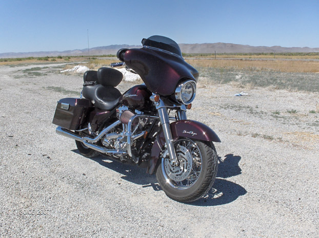
Great ride. about 1250 miles.

Funny thing, and its indicative of my family– We rode out in formation, and on the way home it was every man for himself. They say eagles don’t flock. We’re good for about a day, then we all like to steer our own ships. I’m fine with that. I actually prefer it that way, its the only way I know.

I headed out wednesday night and made Delta. Thats a great ride, and a good road.

Friday Pat and I hooked up with Skip and his sons, and headed out toward Heber to meet up with Mike. Then we hit the road, for the sleepy cat guest ranch.

The weather was near perfect, and its always fun to ride roads that I havent been on much.

I dont remember my Grandpas Ranch, and I havent been to Meeker Since I was a kid. It was great to see my brothers talk about their memories of the place, how they remembered my grandparents, and how they lived. My Grandfather was a good man. Honest and determined. He set the standard and a creedo that I think we all aspire to still. He was a mans man, and worked hard.

We rode out to their grave, and then headed into the sleepy cat for the night, the timing was good, we pulled in just while there was still light in the sky. We ate dinner, shot the shit, had a few beers.

The next morning you could tell it was over. We all had our own schedule at that point, and we rallied just enough to get on the bikes and point em home.

Trip is over, saying goodbye to my family in DuchesneIt rained a little, but nothing too bad. At duchesne I said goodbye to everyone and headed south. Just about 5 minutes later it started coming down. I coulda kept going, it wasnt anything but a bit of a pain in the ass, but I mostly just wanted to have a little time to digest the trip with my brothers and string the trip out for another day. Plus, i figured I knew the storm would break and tomorrow would be good riding. I wasnt going to make it all the way home anyway. So I crashed in Castle Dell.

The next day I rode through some pretty cool roads, up around 9500 elevation, and down through Loa, boulder, and Escalante. highway 12 is the best road in utah I think, at least that ive been on. I hit that, and enjoyed the ride home.

I don’t know how many more times a ride like this will happen. Quite honestly, the best thing about it wasGrand staircase, hwy 12, calf Creek it started off Pat and I riding alot more, and Im pretty sure Ill fill this blog with a bunch of our rides. We’ve already had a few more since then. He’s got the bug as bad as I do.

Ride Totals: 2 states, 1244 Miles

[googlemaps http://maps.google.com/maps?f=d&hl=en&geocode=16681085263153336911,37.133900,-113.602960%3B8384430923399665988,37.617310,-113.601650%3B16327030499567570532,38.732580,-112.965810%3B10880686664237861343,39.345290,-112.600560%3B3303942013080097197,40.636600,-112.289450%3B3910294074889089038,40.587880,-111.977280%3B2248192581192303813,40.399380,-111.919190%3B6371436690570527688,40.294470,-111.725580%3B18188431074546220445,39.946530,-107.769610%3B6442861715600747294,40.162300,-110.375370%3B1694638747464743729,39.230700,-111.016660%3B13380351212045440540,38.701930,-111.400940%3B13073609264956650737,38.418786,-111.644327%3B4401516600505736009,37.743050,-111.559460%3B859115505651780442,37.127480,-113.527310&saddr=UT-18+%4037.133900,+-113.602960&daddr=Bench+Rd+%4037.617310,+-113.601650+to:UT-257+%4038.732580,+-112.965810+to:W+Main+St%2FUS-50%2FUS-6+%4039.345290,+-112.600560+to:UT-36+%4040.636600,+-112.289450+to:Bangerter+Hwy+%4040.587880,+-111.977280+to:UT-68+%4040.399380,+-111.919190+to:I-15+N+%4040.294470,+-111.725580+to:CR-8+%4039.946530,+-107.769610+to:US-40+%4040.162300,+-110.375370+to:UT-29+%4039.230700,+-111.016660+to:UT-72+%4038.701930,+-111.400940+to:N+200+W+St+%4038.418786,+-111.644327+to:UT-12+%4037.743050,+-111.559460+to:37.217206,-112.972412+to:I-15+S+%4037.127480,+-113.527310&mra=dpe&mrcr=4&mrsp=14&sz=8&via=1,2,4,5,6,9,11,12,13,14&sll=37.870517,-112.230835&sspn=1.942627,4.01001&ie=UTF8&s=AARTsJrKA4Me07zBVrHUCz9e1in4jN-DhQ&ll=38.779781,-110.577393&spn=4.110643,7.03125&z=7&output=embed&w=640&h=480]

Meeker Massacre, June 2007 Read More »

Wendy and I, Universal Studios

First long ride with my 10 year old daughter Wendy. We rode out to universal Studios to have some fun.

Made it to Barstow the first night. Wendy did great. she’s a natural. Was worried that she might get bored and fall asleep, but not even close. She’s fun to ride with, and we’re having fun.

Spent 2 days in Universal City, went to universal studios and grauman’s chinese theater and the wax museums, and saw Meet the robinsons in 3D in a cool old famous theater.
Rode home straight through. Both had a bit of TB, but otherwise had a great time.

Ride Totals: 3 states, 962 Miles

[googlemaps http://maps.google.com/maps?f=d&hl=en&geocode=5460195716597490523,37.070312,-113.877478%3B18246488248814879371,36.893380,-113.922860%3B14094962186255828944,37.055350,-113.587260&saddr=Santa+Clara,+UT&daddr=Old+US-91+%4037.070312,+-113.877478+to:Universal+City,+CA+to:37.151561,-113.829346+to:I-15+N+%4037.055350,+-113.587260&mra=dme&mrcr=1&mrsp=3&sz=7&via=1,3&sll=35.728677,-114.949951&sspn=4.137799,9.624023&ie=UTF8&s=AARTsJrYBPOc_c7X5kxSwGoX38WAmqKSbQ&ll=35.728677,-114.949951&spn=12.476838,18.676758&z=5&output=embed&w=425&h=350]

Wendy and I, Universal Studios Read More »

H.O.G. Run through Zion National Park

Southern Utah Harley Owners Group does day runs almost every weekend, and at least one overnighter a month.   I’ve done maybe 3 runs with them.   Great bunch of guys, and very organized.

Megan, my oldest daughter went with me on this one.   Shes a great rider.   The weather was not looking all that great, and the original plan was to head through Zion National Park, and up to antimony.   We ended up running up through cedar city, and over Cedar mountain.  There was snow on the ground, but really wasnt cold.   We stopped in Kanab to get lunch, and the thunderheads looks pretty ominous, so we headed back through the park and home.

H.O.G. Run through Zion National Park Read More »

Finding General Patton

"A good plan, violently executed now is better than a perfect plan next week" - George S. patton

Everything in life is pretty rushed, and demands decisions and results. I think thats why motorcycling is such a relaxing thing, is when Im on the road, there are no time frames. Being home by monday is a loose goal, other than that, anything goes.

Ive always been a fan of George Patton. The first VCR movie my dad bought was Patton. I watched it so much I had it memorized. Ive read his war Journals, and 2 biographies on the rebel and pure leader that was George S. Patton. Before he went to Africa in 1943, he set up the desert training facilities for tank warfare in the california desrert, so I set out to see it.

Left Friday night and made it to Kingman. Holy crap, it was cold. from the time I left hoover dam to kingman, i froze my nuts off. I took a sleeping bag and had every intention of sleeping off the side of the road somewhere and watching a movie on my Ipod, but I was just too cold. I needed to get warm, so i stopped and stayed at the quality inn in kingman, I pulled in around 10 PM.

Amboy CaliforniaWoke up the next morning and headed out by 8. It was a bit brisk in the morning, but the weather was supposed to be warm for the rest of the weekend. Visited the route 66 museum in kingman, bought some videos, and headed out to Oatman, Needles, Goffs, and down to Amboy.

Amboy showed signs of life again. THere were people fixing up the gas station trying to get it selling gas again. Shouldnt be long. From Amboy, I headed south into twentynine palms, and up over joshua tree national park. Nice ride, I’d never been up through there. It got a bit cold up on top, but once I dropped off the mountain it was nice again.

I took a wrong turn though. I didnt notice, untill I dropped into yucca valley. 75 miles out of my way. No big deal. Just more stuff to see, right? I drove through alot of crappy traffic, and down into palm springs where i crashed for the night.

The next morning, I rode the 30 miles to Chiraco Summit and the Patton Museum. Great little museum, andThe tank that won WWII well put together. Watched some videos, geeked out on period memorabilia, and bought some T shirts for me and the kids. After about an hour or so, I headed back through the way I originally intended to go: back up through Joshua Tree and eventually back up through amboy.

After Amboy, I took old route 66 through newberry springs on a really old and unimproved section of the old road. Rattled the kidneys out of me, but I had to do it. I stopped and ate at the Baghdad Cafe. I loved the movie, and ate there before it was called baghdad cafe. Now I get it that these old bypassed route 66 businesses barely make any money, but there is no excuse for a place to be dirty. Baghdad cafe, while proud that it is a route 66 tourist destination, and was in a movie, is disgustingly dirty. I seriously expected to find a roach in my food, and if I wasnt so damn hungry and could eat anything, I wouldnt have. Ill never eat there again. Water is free, and you can clean up on a smoke break. Ive lived and been all over the world, but that was the grossest place Ive ever eaten. Hate to rag on a mom and pop store, but that place is sick. It’s an embarrassment to route 66.

From newberry, i took the fastest option to 1-15 and headed home. Made it home late that night.
Ride Totals:  4 states, 1005 miles, 3 days

[googlemaps http://maps.google.com/maps?f=d&hl=en&geocode=1290206406800517387,37.033873,-113.903979%3B13453564387863889141,34.677810,-115.329760%3B11189909344961434491,34.558290,-115.743880%3B16026456553685595305,34.026290,-116.021110%3B9320697587690912781,33.838494,-116.506286%3B7661895313304558971,33.674038,-115.801787%3B7619845205595214908,34.549770,-115.745520%3B1368643798693246591,34.882880,-117.062210%3B1876023409134450199,36.949900,-113.802670%3B7271237144071785476,37.103100,-113.591940&saddr=Santa+Clara,+UT&daddr=Old+US-91+%4037.033873,+-113.903979+to:Kingman,+AZ+to:National+Trails+Hwy+%4034.677810,+-115.329760+to:National+Trails+Hwy+%4034.558290,+-115.743880+to:Park+Blvd+%4034.026290,+-116.021110+to:N+Gene+Autry+Trail+%4033.838494,+-116.506286+to:Cottonwood+Springs+Rd+%4033.674038,+-115.801787+to:Amboy+Rd+%4034.549770,+-115.745520+to:I-15+N+%4034.882880,+-117.062210+to:I-15+N+%4036.949900,+-113.802670+to:S+Bluff+St%2FUT-18+%4037.103100,+-113.591940&mra=dme&via=1,3,4,5,8,10&sll=37.274053,-112.769165&sspn=1.901369,5.141602&ie=UTF8&s=AARTsJr7TYfabu-V86vNyNo2B7KoGwGCdA&ll=35.710838,-115.114746&spn=6.242927,9.338379&z=6&output=embed&w=425&h=350]

Finding General Patton Read More »

Thunder in the Tunnel 07

Every year, Zion Harley Davidson sponsors thunder in the tunnel.   This was the first year I’ve made the run from the dealership, up through Springdale, through Zion National Park through the tunnel, out to kanab and back through colorado City and then home.  Its a fun little poker run.

This year, Wendy, my 10 year old Daughter went with me.   She’s a fun kid.  Lots of energy, and I like how she looks at life.  She’s just got style.  She also refuses to smile for pictures, and I told her on this run, she didnt have to.  We’re harley davidson owners right?  Isnt there something in the manual about scowling and hiding how much fun you’re having in the name of looking bad and being cool?   I don’t quite pull it off, but maybe Wendy can.

We had a blast.

Theres nothing like the sound of 500 harley Davidsons booming through a 2 mile tunnel.  Wow.  It was awesome.  We left in the morning, and got back around 3 PM, had a nice lunch, and rode around with some friends.

Thunder in the Tunnel 07 Read More »

Death Valley Weekend Trip

I dont mind riding by myself. I had a couple people who I tried to go on a weekend run, but when they couldnt, no big deal. Sometimes its nice to not have to hassle with seeing what everyone wants to do, who gets up late, or where we go, or whatever else. Im out there to RIde, see as much as I can, and push it a bit. I’m pretty self contained, always have been.

I wanted to see edwards air force base museum, So friday afternoon I headed out over the Utah Hill towards Las Vegas. Traffic through vegas was terrible. NASCAR was in vegas that weekend, and I managed to time it to go through I-15 just as the race was over. It took an hour to get down the freeway. I didnt think I’d make barstow now, so stayed the night in Jean. Called robyn and talked to her for a few, then crashed for the night.
The next morning I woke up, loaded up, and headed to barstow. The weather was really nice for march. Not much wind, and with leathers on, it was perfect. Great time to ride.

having XM radio on my bike is awesome. Being out on the open road listening to the Pittsburgh Penguins is even better. Maybe the best. I have to slow down to hear the games a bit, so the time I hit Boron, I decided to putt around town and listen to the end of the game. I’d never seen boron anyway. They beat the rangers at home, 3-2 on OT.

While cruising through Boron, I noticed a little small town museum that every little town seems to have. This one had an F-4 phantom outside, so I stopped in and checked it out. Apparantly, most of Erin Brockovich was filmed in Boron, and they had a big section of the museum showing props and pictures from the film. Boron is also named after the borax that’s mined nearby (remember 20 mule team borax?). In the museum, the lady also told me that Edwards air force museum is closed, and shown by appointment only. The museum with the F-4 next door was also closed due to some water damage a week ago. No big deal. Its all about the ride, right? not the destination. I spent about an hour at the museum, and headed out.

I doubled back and headed up to death valley. The ride was nice, and not alot of traffic. Around dusk I headed up out of the valley, and figured I’d stay in Pioche. Wrong. The only room in Pioche was next door to the whore house, and I didnt want to explain that on my credit card statement so bit the bullet and headed home. Damn NASCAR fills up every room, including pioche.

The ride home was pretty Cold, but I survived.

[googlemaps http://maps.google.com/maps?f=d&hl=en&geocode=2529145954676378729,37.074110,-113.871288%3B1588160004156874949,34.898660,-117.013630%3B12610790526669746497,34.999560,-117.649730%3B8547367140846301567,36.604340,-117.105560%3B12487628570630521048,36.214630,-115.992230%3B11223778173515209210,37.133650,-113.605890&saddr=Santa+Clara,+UT&daddr=Old+US-91+%4037.074110,+-113.871288+to:Jean,+nevada+to:E+Main+St+%4034.898660,+-117.013630+to:20+Mule+Team+Rd%2FTwenty+Mule+Team+Rd+%4034.999560,+-117.649730+to:CA-190+%4036.604340,+-117.105560+to:NV-160+%4036.214630,+-115.992230+to:37.079284,-113.878784+to:W+Snow+Canyon+Pkwy+%4037.133650,+-113.605890&mra=dpe&mrcr=5&mrsp=7&sz=9&via=1,7&sll=36.569218,-114.658813&sspn=1.023524,2.570801&ie=UTF8&ll=36.315125,-115.092773&spn=1.023524,2.570801&output=embed&s=AARTsJqsk_6t_VRC-LxxxD6P-EvY8xfs0g&w=425&h=350]

Death Valley Weekend Trip Read More »

St George to California, Day 7

We left Tusayan and drove through the South Rim of the Grand Canyon about 10:00 AM and headed for home. It was on highway 89. Not much to see. Its mostly indian reservation & Dirty little towns. There seems to be more Stands selling indian jewelry than the homes they live in. We got gas at the Gap, travelled for a few hours till Jacob Lake where we gassed up again and ate. We loaded up, and headed for the final stretch home. The trip was over, and I know if we had more money Robyn would agree we’d have stayed longer. I was familar with the road home so I just opened it up and we did 80 most of the way. The best vacation I’d ever been on was over. It’d been like a dream we’d waited for since before we were married and it was done now. I was sad to see it end.

Total Miles: 1169

Total Money Spent: $635.00

Souveniers:

  • 2 Disneyland T Shirts
  • 2 In-n-Out burger T shirts
  • 3 route 66 T shirts
  • 1 Route 66 book by michael wallis
  • 1 Route 66 pin
  • 1 Disneyland Key Chain
  • $2 watch
  • 1 Disneyland book

Items Lost:

  • 1 bota bag full of water (somewhere on route 66)
  • 1 American flag (on route 66)
  • 1 watch (on splash mountain)
  • 1 thing of carmex
    [googlemaps http://maps.google.com/maps?f=d&hl=en&geocode=11440821376616549264,35.957290,-112.131900%3B16062662589442223005,37.109950,-113.583300&saddr=US-180+%4035.957290,+-112.131900&daddr=36.925743,-112.294006+to:E+St+George+Blvd+%4037.109950,+-113.583300&mra=dpe&mrcr=0&mrsp=1&sz=9&via=1&sll=36.564806,-112.563171&sspn=1.868426,2.927856&ie=UTF8&s=AARTsJqAfGosUXjkn8_qdJrrJP0GMYEsDw&ll=36.564806,-112.563171&spn=3.088333,4.669189&z=7&output=embed&w=425&h=350]

St George to California, Day 7 Read More »

Day 6: Route 66

Waking up in Kingman on Route 66We stayed at KOA in Kingman and headed out to my favorite stretch I’d been on yet. It wasn’t as deserty as the california stretch and the road was good. We stopped at Grand Canyon Caverns and at Seligman.

At Seligman I had the best burger I’ve ever had in my life at Juan Delgadillos Snow Cap. Juan is a nut. We took a walk down Seligman and found his brothers store, that had all sorts ofSnowball Palace, Grand Canyon Caverns route 66 stuff. We bought 2 T-shirts and a book, and talked for an hour or so. Seligman is a town that refuses to die, and it seems mostly due to the delgadillo brothers. Out of all the route 66 towns Amboy and Seligman seem to have the 66 spirit and wont let it die. The others don’t seem to care too much that I noticed, they were dealing with it.

Anyway, we took a few pictures and some info and left seligman. We passed the crooktown road exit and went into ash fork to get gas athe chevron station. Tried to find the road and bridge that was in the Rider magazine. We never found it. We crossed the railroad tracks, but I think we should’ve gone left instead of right. I was afraid of getting a hole in my tire, and wasnt all that sure it was, so we headed back through ash fork and said goodbye to route 66. On the way to williams, there was a really big abandoned stretch we noticed.Mummified Bobcat,  Grand Canyon Caverns

We went through Williams and the ride was great untill we got to the grand canyon. What a crowded tourist trap! We stayed just outside the park in Tusayan and it sucked. Windy, dirty and noisy. Helicopters constantly landing and taking off right next to the campground.

[googlemaps http://maps.google.com/maps?f=d&hl=en&geocode=17993792335159316445,35.527404,-113.432183%3B17089950981724175164,35.320728,-112.849290%3B1487652939200003640,35.967730,-112.129110&saddr=kingman+AZ&daddr=AZ-66+%4035.527404,+-113.432183+to:35.317366,-112.818604+to:US-180+%4035.967730,+-112.129110&mra=dme&mrcr=0&mrsp=2&sz=10&via=1,2&sll=35.290469,-112.723846&sspn=0.949413,1.463928&ie=UTF8&s=AARTsJrA2MgSicKspQazD69XdpZMPL18sQ&ll=35.541166,-112.994385&spn=1.564398,2.334595&z=8&output=embed&w=425&h=350]

Day 6: Route 66 Read More »

Day 5: First Day on Route 66

Robyn at Roys on Route 66
Robyn in 1991 at Roy's in Amboy

Rode 404 miles today.

We left Anaheim about 10, somewhat reluctantly. Disneyland for 2 days was a blast. We rode splash mountain 5 times (one of which I lost my watch on) and if the park wouldnt have closed at 10 instead of 1 AM like we thought, we wouldve probably done every ride twice. We could have spent a week there.

Anyway, we took highway 5 to 405, north on 55 onto 91 and then 1-15 North. We got off on a part of route 66 near Cajon pass. It was only about 8 miles but it already showed a few casualties of the interstate. It was once a two-laner and I think we missed a little of it and couldve found more. Then it was 1-15 through to Barstow. At Dagget, we found old trails highway, ol’ route 66 again. we went through newberry springs, a little town practically under the 1-40 underpass and stopped 30 miles later at ludlow to get a gatorade. 1/2 hour later, we were in Amboys at a place called Roys. Its owned by Buster Burris, who said he’d been there 50 years. He was rad! We ate, bought a T-shirt, talked for a while about route 66 and headed for cadiz or chambless to get gas. Then, we went through goffs, a shmeggy little place buster showed us that was the OLD route 66. Then it was to 1-40 untill we hit Topock. I know we missed alot of it.

We rode through Oatman, and old ghost town that had closed down by the time we got there, but did have a sarsparilla and headed out. Oatman and goldroad was pretty interesting. At one time it had 10,000 people and now it has 100 people…… maybe.

Rode into Kingman for the night to the KOA. Windy day, but a nice ride.

[googlemaps http://maps.google.com/maps?f=d&hl=en&geocode=7496869689303502543,33.832830,-117.919180%3B15118096633822049589,33.774681,-117.860081%3B2566601709567911381,34.253809,-117.459432%3B446161051617951934,34.347216,-117.468695%3B9071864067465498029,34.732010,-117.326530%3B2626768883307202373,34.885910,-117.029950%3B15563764665090701006,34.555420,-115.756240%3B11155277860971333610,34.828370,-115.051380%3B14065704722403104914,35.190600,-114.064000%3B7952691562820891419,35.021510,-114.382950&saddr=S+Harbor+Blvd+%4033.832830,+-117.919180&daddr=S+Parker+St+%4033.774681,+-117.860081+to:Cajon+Blvd+%4034.253809,+-117.459432+to:I-15+S+%4034.347216,+-117.468695+to:National+Trails+Hwy+%4034.732010,+-117.326530+to:I-15+N+%4034.885910,+-117.029950+to:National+Trails+Hwy+%4034.555420,+-115.756240+to:National+Trails+Hwy+%4034.828370,+-115.051380+to:35.029996,-114.375916+to:W+Beale+St+%4035.190600,+-114.064000+to:CR-153+%4035.021510,+-114.382950&mra=dpe&mrcr=2&mrsp=8&sz=9&via=1,2,3,4,7,8&sll=35.041241,-114.400635&sspn=1.904607,2.927856&ie=UTF8&s=AARTsJpGwnVIqVEYBVDpMe_xCbhcZ5vh9A&ll=34.660322,-116.026611&spn=3.162626,4.669189&z=7&output=embed&w=425&h=350]

Day 5: First Day on Route 66 Read More »